Aerosol
Aerosol Optical Depth (AOD)
Aerosols Radiative Forcing in Trans- Himalayas
Trans-Himalayas
World Food Safety Day (WFSD)
Task Force for Women
Maternal Mortality Ratio
Infant Mortality Rate
Total Fertility Rate
Sex Ratio at Birth
Child Sex Ratio
Mangroves
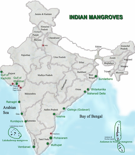
Sundarbans
Solar micro-grids in Sundarbans
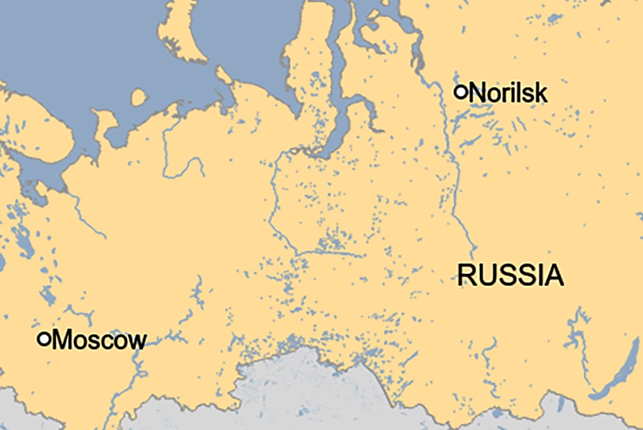
Oil Spill in Krasnoyarsk
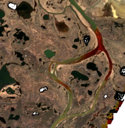
Permafrost
Source: PIB, Down to Earth, News on AIR


