China plans to build a 1,000-km tunnel to divert water from the Brahmaputra in Tibet to the dry Xinjiang region.
This has created worries about Brahmaputra getting dried up, especially in Assam.
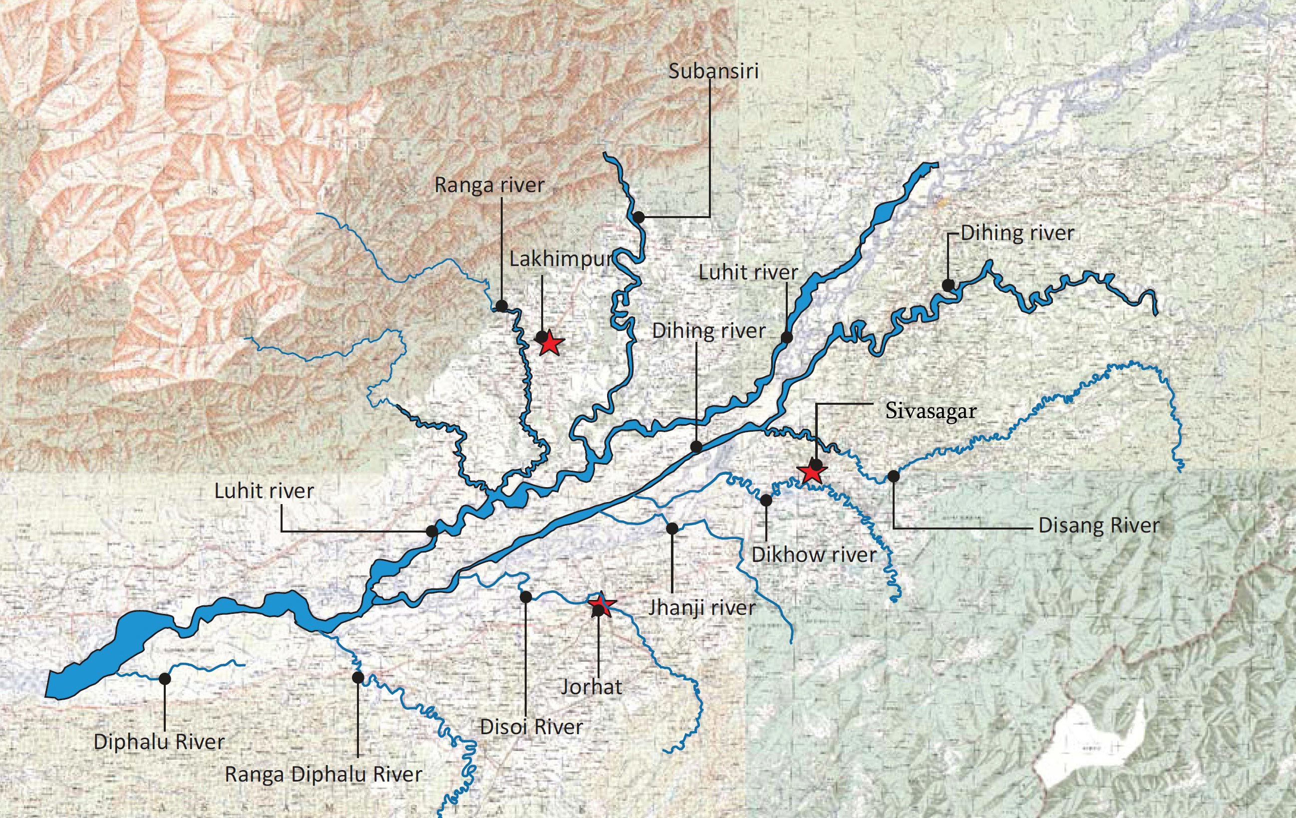
What constitutes the drainage route of Brahmaputra?
Out of the total length of the Brahmaputra of 2,880 km, 1,625 km is in Tibet flowing as Yarlung Tsangpo.
918 km is in India and known as Siang, Dihang and Brahmaputra.
The rest 337 km in Bangladesh has the name Jamuna till it merges into Padma near Goalando.
As a trans-Himalayan tributary, Yarlung is substantially fed by snow and glacial melts, in addition to rainfall.
Why India shouldn’t be worried?
There fears are hardly based on objective data-based analysis.
Melting snow contributes merely 15-20% of the total volumetric discharge of the river.
Catchment - With the Himalayas acting as the barrier, Tibet is a rain shadow region with an annual precipitation of about 300mm.
As the tributaries cross the Himalayan crest line, the annual average precipitation reaches about 2000 mm.
Hence, a very large component of the total annual flow of Brahmaputra is generated to the south of the Himalaya in India.
Flow Rates - While the total annual outflow of the Yarlung River in China is estimated around 31BCM, the same for Brahmaputra towards the end at Bahadurabad in Bangladesh is about 606 BCM.
Further, the peak flows at the ‘Tsela Dzong’ measuring station near the great bend in Tibet, is about 10,000 cumecs.
But the peak flow at downstream Guwahati is around 40,000 cumecs and at Bahadurabad in Bangladesh is 50,000 cumecs.
Similarly, during the lean season, flows at the mentioned locations read 400 cumecs, 4000 cumecs, and 5000 cumecs respectively.
Implication – The above data implies that the Brahmaputra gets fatter and mightier as it flows further downstream.
This is also because of the contributions of various tributaries like Dibang, Luhit, Subansiri, Manas, Sankosh, and Teesta.
Can water diversion affect sediment flow?
Currently downstream Brahmaputra carries a huge sediment load on its run towards the sea.
River volume in the Yarlung River is not sufficient to generate and transport large sediment load.
Notably, the annual suspended sediment load near the Arunachal border in Tibet is around 30 million metric tonnes.
This is miniscule when compared to 735 million metric tonnes at Bahadurabad in Bangladesh.
Therefore, the large sediment load is created only in the downstream region in India.
What is the way forward?
In the case of Brahmaputra, initial evidence suggests that Chinese diversions can’t have a substantial impact on the Indian and Bangladeshi drainage networks.
It should be understood that structural interventions does not always reduce downstream flows.